Dubai's metro system is a fast, safe, and affordable way to get around this vibrant city. Whether you are a resident or a visitor, knowing how to find the closest Dubai Metro station is key to enjoying an efficient commute or sightseeing experience. This guide will walk you through all the best methods to locate the nearest metro station with ease.
Navigating Dubai's metro can seem daunting at first, but finding your nearest station is simpler than you might think. Thanks to smart apps, interactive maps, and helpful local insights, it's now easier than ever to pinpoint a Dubai metro station near me and plan your route in minutes. Keep reading to explore practical tips and tools to stay connected to this comprehensive transit network.
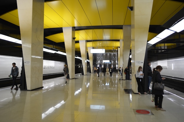
Finding the closest Dubai Metro station to your location is essential for seamless travel and quick access to the city’s rich cultural and commercial hubs. If you find yourself near the historic Bur Dubai district, the Al Ghubaiba Metro Station is an ideal choice. Situated adjacent to the al ghubaiba bus station, this metro stop on the Green Line provides an excellent transit link to numerous attractions such as Dubai Creek, the Al Fahidi Historical Neighborhood, and the Dubai Museum.
By choosing Al Ghubaiba Metro Station, travelers can enjoy easy transfers to various bus routes, water taxis, and other public transportation options. This connectivity makes it straightforward to explore nearby sites and navigate to other parts of Dubai efficiently. When planning your visit or commute, considering metro stations close to major bus hubs like Al Ghubaiba enhances your transit experience, offering a smooth journey connected to the broader network including popular locations served by the station's metro and bus interchange
Use Official Dubai Metro Apps and Smart Tools
Dubai offers several dedicated apps designed to make metro travel a breeze. These smart tools come with real-time updates, interactive maps, and journey planners that adapt to your location.
-
Dubai Metro App: The official app provides GPS-enabled nearest station locators, live train timings, fare calculators, and journey planning tools.
-
RTA S'hail App: Offers not only metro station locations but also comprehensive public transport modes, including buses and trams.
-
Google Maps: Simply typing "dubai metro station near me" will reveal nearby stations, directions, and estimated travel times.
These apps often include additional features like alerts for service disruptions, accessibility support, and tips for first-time riders.
Explore Interactive Metro Maps
If you prefer visual planning, interactive maps of the Dubai Metro lines are invaluable. These can be zoomed to view nearby stations relative to your location. Maps distinguish between the Red Line, Green Line, and extensions, so you can easily find the closest stop.
Interactive metro maps usually highlight:
-
Station entrances and exits
-
Connections to bus stations or taxis
-
Nearby landmarks to guide those unfamiliar with the city
Ask Locals and Use On-Ground Signage
Dubai's metro system is well-marked with multilingual signage and helpful staff. For those who enjoy a personal touch:
-
Ask locals or station employees for directions to the nearest station.
-
Look for road signs and bus stop information boards pointing toward metro access points.
This method is especially handy if you have limited digital access.
Practical Tips to Make the Most of Your Search
-
Ensure your smartphone's location services are enabled when using apps for accurate results.
-
Download metro maps offline if you worry about internet connectivity during your trip.
-
Purchase a Nol Card - Dubai's official travel card - for easy access and smooth transitions between metro, bus, and tram.
-
Look out for major metro stations near popular locations such as Burj Khalifa, Mall of the Emirates, and Dubai Marina to orient yourself.
Key Takeaways
-
Using the Dubai Metro App or RTA S'hail App is the fastest and most reliable way to find the nearest metro station.
-
Interactive maps provide a clear visual guide and help you plan your route proactively.
-
Asking locals and reading signage can simplify your journey when mobile access isn't available.
-
Don't forget to carry a Nol Card for seamless travel across Dubai's transport modes.
Frequently Asked Questions (FAQs)
Q1: How do I find the closest Dubai Metro station to my current location?Use GPS-enabled apps like the Dubai Metro App or Google Maps and search for "dubai metro station near me." These will guide you with real-time directions and travel times.
Q2: Can I use a Nol Card to pay across different metro lines and buses?Yes, the Nol Card works on all Dubai public transport, including metro, buses, and trams, making transfers simple and cashless.
Q3: Are Dubai Metro stations accessible for people with disabilities?Yes, Dubai Metro stations are equipped with elevators, ramps, and other facilities catering to passengers with reduced mobility.
Q4: How often do metro trains run in Dubai?Metro trains run every few minutes during peak hours, making it convenient to catch a train anytime during the day.
Q5: Can I plan a metro journey offline?Many apps allow you to download maps and schedules for offline use, useful in the absence of internet connectivity.
Conclusion
Finding the closest metro station with the phrase "dubai metro station near me" has never been easier thanks to technology and clear metro infrastructure. By using dedicated apps, interactive maps, and local guidance, your journey through Dubai's metro system can be stress-free and enjoyable. Whether you're commuting to work or exploring Dubai's attractions, this knowledge helps you connect with one of the world's most modern metro systems effectively. For more detailed metro station guides and travel tips, continue your journey at stations.ae.